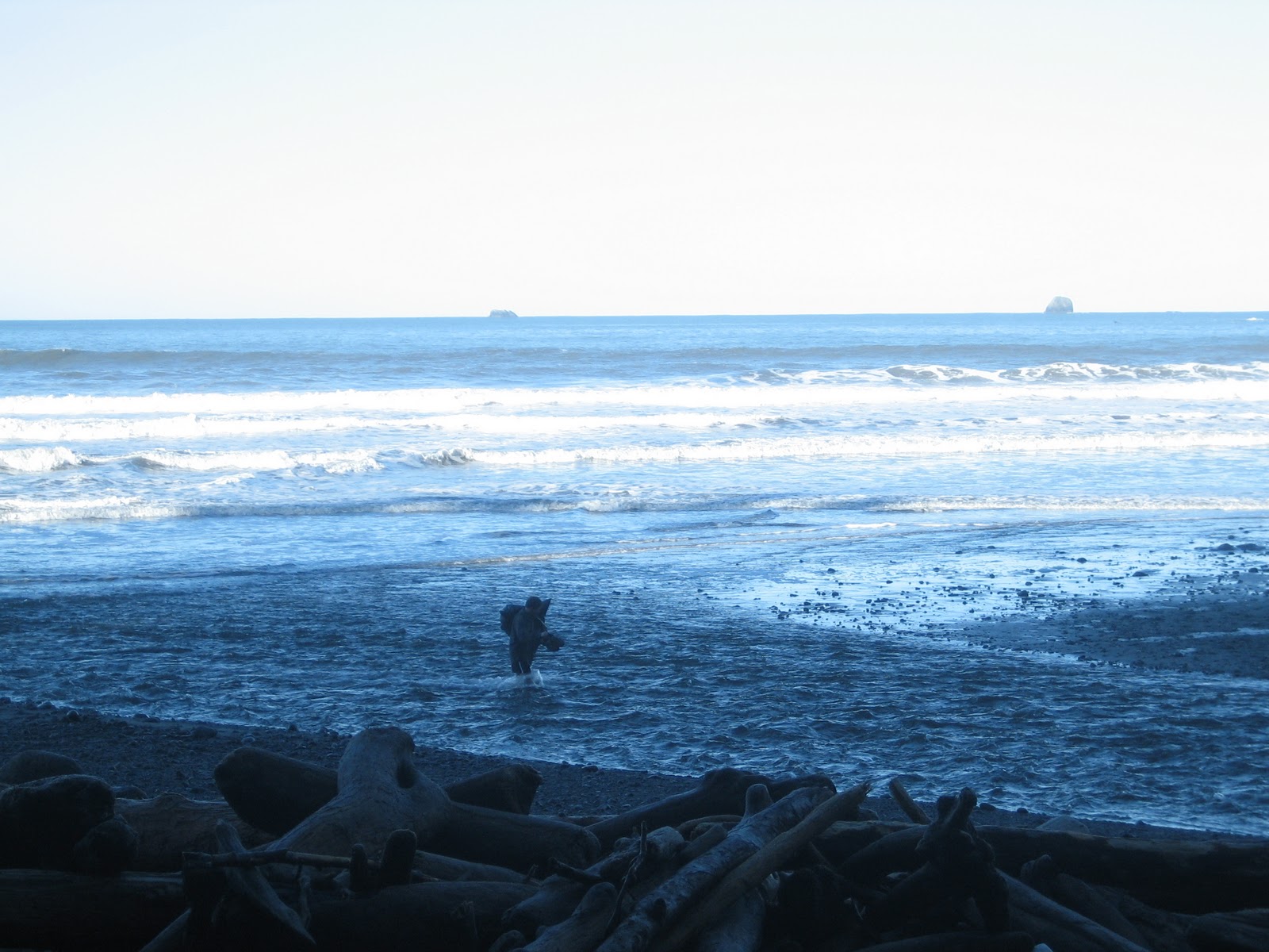
Thursday, February 24, 2011

Olympic National Park Slideshow


Here is the link to the web album.

Olympic National Park


Here is the link to J's web album.  Here

Day 3 & 4:Strawberry Point to Mosquito Creek. Olympic National Park

J, Matt and I

 During the night, it was cool to be able to tell what time it was by how loud the waves were due to the changing tides. In the morning, I awoke to the call of J informing me that a bald eagle swooped by with a fish in his talon. I didn’t fully comprehend this at the time, but I popped my head out of the darkness of my sleeping bag only to be blinded by the early morning light. Needless to say that I missed the show. We ended up sleeping in a little, but J got up a little earlier than I did in order to check out the tidal pools during low tide. I laid in my sleeping bag for a while struggling with the notion of putting on wet socks and wet shoes. I could still see my breath, but knew I had to get out there to check out the tidal pools. By the time I rallied and got to the tide pools on the cape, I was honestly more happy to get into the sun than look at the sea anemone. J was way out on the point so I stuck to rock hopping closer to the beach. I watch three bald eagles, one full grown, white headed adult and two juveniles, cruise in and out of the forest. They seemed as happy to see the sun as I did. Eventually I headed back to camp and began snapping some pictures and getting my breakfast going. Note to self: I need two packets of oatmeal a morning, not one. J came back sometime later and we both ate breakfast and sipped hot tea before lazily packing up. We decided to forgo the plan of heading down to Strawberry Point because it was already noon and we needed to get back across Mosquito Creek and meet up with the other guys.
Once we were fully packed up, we headed south back down the beach. In the distance, we could make out a day hiker approaching us from the south. While we had seen a few other people in camp the night before, we didn’t expect to see anyone on the way back this early in the day. We joked that Matt might have been ambitious enough to head this way, but we fully expected to see him somewhere around Goodman Creek, where the ford was very difficult. Low and behold, the distant hiker materialized into our long lost hiker, Matt. He told us that he wanted to go to Strawberry Point and that Joel had decided to head back early so we didn’t need to meet up with him. We decided to join him and headed out to the point, where we ate lunch and scanned the sea for wildlife. We ended up seeing sea otters and harbor seals along with a multitude of birds. J could tell you more about this, but I saw some ducks, little birds, skinny birds, bigger birds, sea gulls and bald eagles. J also taught me about lippets, chitons, blue mussels and sea stars, however, im sure that im missing something.

Best latrine I've ever seen
We spent the afternoon around Toleak Point and Strawberry point. We also found an old A-Frame shelter from the early 70s along with an open door outhouse overlooking the entire bay. One of my favorite latrines of all time I must say. From there we headed back to the Mosquito Creek campsite. We crossed the Falls Creek, Goodman Falls (where the water had subsided quite a bit, making a ford a little more manageable, headed up and down a few ladders and eventually crossed Mosquito Creek at low tide in the waning daylight hours.

J on the left and me on the right


J and I set up our shelters once again, while Matt prepared a fire. That evening, we finished off most of our food, polished off our liquor, listened to Matt play the harmonica and watched the fire dwindled into ashes. We had another tidal start in the morning in order to get around Diamond Rock, so we opted to take the overland trail instead of the southern beach route in case we got lost or missed the tide. J had to be back in Corvallis by 7 so we were on a tight schedule.


Monday morning, we packed the camp up in the dark and were on our way 7am. We carried a decent pace, but took our time to enjoy the last few hours of our adventure. We rock hopped our way across Diamond Rock at 10am and decided to eat lunch by the Hoh River, where a sea was fishing for salmon. I hiked on ahead to prepared the car and present the victory beers because every good adventure must be concluded with a celebration of  hops. (Mirror Pond and Red Chair NWPA by Deschutes Brewery!) We ate the last of our food and jumped in the car to head back to Portland, where J and Matt would which to Matt’s Suburu to finish the journey. In the end, it was an amazing adventure. It had its hard times, but I was always rewarded for the work. I want to thank my uncle J for inviting me on this trip and I hope that there are many more in the future. But with the newest addition to the Feldmann family coming soon, J will definitely have his hands full. To Matt, I hope to be a member of Team Mosquito on the next trip. Thanks for the laughs. And here’s to Joel, the man, the myth and the legend.

UNT

Bryan


Wednesday, February 23, 2011

Day 1 & 2: Diamond Rock to Toleak Point. South Beach Wilderness Trail, Olympic National Park


Coastal Olympic National Park - President's Day Weekend - February

We left Portland around 6:15p in the middle of rush hour and in the pouring rain, but we got into the campground on Oil City Rd right at roughly 1am. The sky was clear with the full moon illuminating the cold, damp campsite. J threw down his bivy, Matt popped up his tent and I folded down the seats in the back of the Green Machine. The following morning we awoke to the sound of drunken shenanigans by our fellow campers, we didn’t mind so much as they proved to be good alarm clocks. We had a tidal start (as opposed to an alpine start) at 5am in order to get around Diamond Rock before the tide trapped us on the southern end. With the addition of Matt’s friend, Joel, we started down the trail at 6am with dawn quickly approaching.  Once we got around Diamond Rock, J and I started humping it to Mosquito Creek in hopes of crossing it before high tide made the ford sketchy due to the high volume of water. After a muddy trail section in the woods above the beach, I made it to Mosquito Creek in time to see J fording his way across the river. I quickly and carefully crossed the icy drift wood log jam leading to the creek and began stripping off layers. The rocks and logs still had ice on them as I stepped into the frigid water. With my pack flung onto my shoulders and my delicate feet blindly feeling their way over the rocky creek bed, I made my way across the creek. Water lapped up my chest as I fought to remain upright in the strong current. Dropping my pack could prove a deadly or at least miserable mistake as I had almost no way to dry my clothing and sleeping bag, except for the power of the sun. I made it across safely and tip toed my way into the loving embrace of the sun’s rays. J forged on ahead to locate a safe spot to wait out the incoming high tide. Matt and Joel would not be able to cross the now swollen creek unless they wanted to swim. We left a note in the sand and headed down the beach to find a good resting point.

Approaching Diamond Rock
Later in the day, we were able to go back and talk to Matt, where he informed us that he and Joel would be camping on their side of the creek tonight. With that news, J and I darted our way down the coast, skirting the reaches of the high tide. When we finally came to the end of the beach, we made our way up the rope and log ladder leading up to the higher forested trail. Our next challenge would be crossing Goodman creek further down the trail. We trekked through a forest of hemlock and spruce with a salal and sword fern understory.  The trail was muddy and washed out in many places but we were made to keep a good pace. When we arrived at Goodman Creek around 3:45p, we spent a good half hour debating how to cross this wide and voluminous creek. I later found a manageable section a little upstream that we felt was swimmable. We stripped to our skivvies, dry bagged what we could and garbage bagged the rest. J got packed up the quickest (a theme of the trip) and I watched as he made his way across the creek. Luckily, he didn’t have to swim and was able to wade across rather easily. I followed suit and we both made it to the other side, shivering and laughing as we reassembled our wardrobe.

J crossing Mosquito Creek
We bushwhacked our way back to the trail and rounded to bend to find a spectacular waterfall. Unfortunately, we had another creek to cross. It was barely shin high, but still required me to remove my socks and shoes. J and already gotten his feet wet and proceeded across quickly in his shoes, while I removed my footwear. I REALLY didn’t want wet shoes for the remainder of the trip. I was already cold enough.

Approaching Toleak Point
Back on the trail, we made it back to the beach just in time for a spectacular sunset. We stood for awhile admiring the beauty of our surroundings before climbing down the steep ladders leading to the beach. We quickly strolled down the beach during low tide, snapping pictures of the sun setting through the natural arch in the sea. The wind had subsided to barely a breath as we approached Toleak Point. We had one last creek/drainage to cross, but we were so happy to be almost at our campsite that we didn’t fully plan our way across the river. We got half way jumping from rock to rock before we noticed that we weren’t going to made it without stepping in water. Damn! Up until this point, I had been able to keep my feet dry.  Now my socks and shoes were soaked. It would prove to be a long night for my toes.


After securing a campsite after much debating and searching, J quickly set up his camp (traits perfect after months on the PCT), while I fumbled around with my set up. After the tarps were secured we cooked dinner, looked at the stars, drank tea and guzzled whiskey and then settled in for a long, cold night.

UNT

Bryan

P.S. Slideshow to come...


Crossing Goodman Creek
More video to come shortly

Tuesday, February 15, 2011

Tiger Mountain


I had a wonderful Valentine’s day weekend. I headed up to Seattle to visit Kerrie and spend some time with her. We visited a few breweries and bars, as well as the ever popular, Pike’s Place Market. Since I was going to be up in the Seattle area, I wanted to try out some of the local trails. After some research online and talking to a park ranger at REI, I decided on Tiger Mountain, although Cougar Mtn, and Rattlesnake Mtn looked really good as well. I settled on a 10ish mile loop linking a lot of different trails together. I had to run with a map because there were so many trail junctions. In the end, I ended up forgetting my water bottle and waterproof camera case at Kerrie’s house so ran without water and without my camera/phone. Bummer. The trail that I chose climbed all the way to the top of the mountain and got up to a little under 3000 ft after starting at 500ft. Definitely, my biggest climb of the year and showed me how much training I need to do in that area. I decided to bomb back down the mountain because I was behind schedule and had to make it home for our dinner reservations. My quads are still super sore, but I like it. All in all it was a great trip, just wish I had my camera.

On another note, I currently in the process of planning a backpacking trip for President’s Day weekend on the Pacific Coast of Olympic National Park. I am hoping this is going to be some A1-2 fun, but with a tight weather window and cold temps, it could turn out to be quite the adventure. My uncle J is leading the trip so that takes some logistical pressures off me which is nice and he is definitely more experienced than I am with this sort of thing. I am happy/embarrassed to say that this will be my first multi-day back packing trip. Up to now I’ve only been on overnights due to my busy schedule. More to come on this adventure…

UNT

Bryan

Wednesday, February 9, 2011

Storeyburn/ Gales Creek Loop


When Sunday morning came around, I pulled the Batmobile (aka my bike) out from the garage, lubed the chain, aligned the brake calipers, leveled off my shocks and pumped up my tires. The Batmobile was now ready for action. I just hoped that Batman had the legs for what was in store for the days ride. I decided that the figure would need to wait for another weekend since my legs were tired and for the simple fact that I had never been on the Storey Burn trail and didn’t know what I was getting myself into. I knew the trail would have lots of climbing and that the trail conditions were probably going to be pretty muddy so in the end an exploratory mission ended up being the best plan of attack for the day.  

Gales Creek CG is closed and gated for the winter so the early season TH becomes the gated pullout off Hwy 6 just about a mile up from the campground. When I got there, the default Th was pretty much full (outdoorsy ppl love to go out on Super Bowl Sunday when the trails are mostly devoid of human contact). The only people I saw all day were at the trailhead J. The ride was pretty uneventful for the most part so Ill spare you the borrowing details. In summary, the climbs were hard for my tired legs and the trail was mostly good except for descending down Gales Creek trail from summit of Hwy 6, it got really muddy and slick, resulting in two pretty good falls for myself.  Another thing to note is that there is now another trail up at the TH for Storey Burns called Sickter Lars. (It is not listed on my adventuremaps.com map of NW Oregon, maybe the new one has it?) This is a short, expert only, all mountain/downhill trail. Yes, I gave it a whirl and had to dismount many times so it’s not worth repeating, but it is good to see that new, properly marked, legal trails are being built in the area. I finished the ride in roughly 2.5 hours and cruise back home to watch the Super Bowl and took part in a self-afflicted food coma.


UNT


Bryan


Eagle Creek Trail

Tunnel Falls
 I had big plans for this past weekend that I was really looking forward to so I am happy to say that everything came together pretty well. I know that for a fact because I am still very sore and tired, sitting here at my desk on Monday morning. My plan was to check some things off my adventure to-do list: trail run up Eagle Creek to Tunnel Falls in the Gorge and mountain bike the Storey Burn/Rogers Camp figure 8 in the Tillamook State Forest. While I completely accomplished my trail running plan, I only managed to partially complete the mtb ride (Storey Burn/Gales Creek loop). (I'll break this into two posts.)

Saturday morning, I got up an early start (for me at least, especially for the weekends) at 8am and was at the Eagle Creek TH by 10:30ish. (roughly an hour drive from my house with no traffic). The TH parking lot was almost full as this is one of the most popular trailheads in the entire Gorge. In typical Gorge fashion, I suited up and headed up the trail in light fog with a misty breeze.  This trail has numerous waterfalls, sketchy cliff slide traverses and a few canyon spanning bridges, along with a handful of good primitive campsites and LOTs of people (ie most popular trailhead in the gorge). The trail conditions were alright, slightly muddy in spots, but the most important thing to note is that the trail is VERY rocky and uneven almost the whole way. 

I took my time on the way up, stopping and photographing almost all the major waterfalls. The scenery was absolutely amazing. I haven’t really spent all that much time hiking/running in the Gorge so I am now trying my best to experience all that it has to offer and will be coming back as often as I can. I hope to use the Gorge Waterfall 50k as a training run for the upcoming Peterson Ridge Rumble 40M in April. This 50k will be the best way to experience a lot of the Gorge and get a long, supported training run in. 

Punchbowl Falls

I got to Tunnel Falls and was able to experience it alone for a few minutes before some day hikers came up behind me.  I continued on past Tunnel Falls to Crossover Falls and another unnamed falls roughly a quarter mile up the trail. I ate a snickers under a rock overhang next to the falls then donned my shell and bombed back down to my car without stopping.  All in all it was an excellent run in decent weather. It’s now one of my favorite trails, however I would only do this again on a weekday when there are less people. Maybe I can get Adam to accompany me...

The "potholes" and the "trail"

UNT

Bryan


Around 30 rock cairns