"I behold the grandest and most pleasing prospect which my eyes ever surveyed."
-Captain Clark, from the view atop Tillamook Head
The weather was looking good for the weekend so I wanted to get some camping and training in. Originally I had planned to camp along the Middle Fork of the Willamette, but my roommate Andrew suggested the coast. I remembered that I had mapped out a few runs on the Oregon Coast Trail, and after some quick calculations to see if I could get in a marathon distance, I agreed to the change of venue.
I left directly from work and arrived at Nehalem Bay CG around 6:45p on Friday night. After one too many loops around the CG looking for the best site, I settled with F21. Solid choice.
Leg 1: Tillamook Head Traverse OAB
The next morning I ate a quick bfast then headed out to Ecola State Park. I had somehow never been there before so I was looking forward to checking out the site and getting on a new trail system. The weather was cloudy, but in the high 50s. My first leg of the day was an OAB traverse of Tillamook Head. I guessed it was somewhere in the 12mi range so I only took one bottle of nuun and one of perpetuem to start the day off right. At the last minute, I threw on my Nathan pack just so that I could easily carry my iPhone in the front pouch.
 |
| Mobile Basecamp |
I made a pact with myself not too take any pictures till the halfway point in order to keep moving, to give myself a few breaks on the return leg, and because the weather was supposed to get better later in the day = better pictures. Now I planned the runs of the day based on Mr. Sullivan’s Oregon Coast Guide Book, but too be honest, I didn’t really pay too attention to exactly mileage and elevation gain, I just knew I’d be over 26.1.
 |
| Took a few laps up this road looking for the trail |
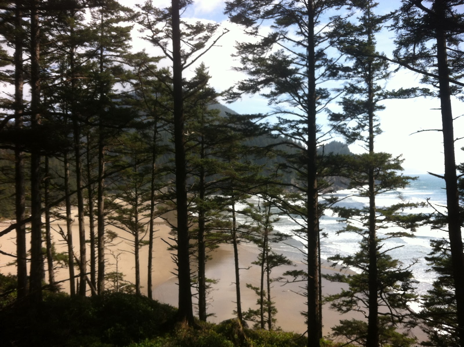
The run from Ecola Point to Indian Beach was short and scenic. I noted a few good spots to take pictures on the way back. I got a little confused on the correct path/trail/road to take in order to get the scenic path to the backpacker’s camp. After a few short OABs on the fireroad, I finally jumped on the correct “trail” and started climbing, and climbing. Whoa, more climbing than expected, more roots than expected, less mud than expected, but definitely lots of it.
 |
| Backpacker Camp |
 |
| WWII Radio/Radar Bunker |
 |
| Terrible Tilly standing fast |
I passed the camp without stopping and continued climbing, tip toeing around roots and shoe sucking mud pits. I passed a few groups of backpackers and hikers, making their way towards the shelters. I soon realized that I was going to over shoot my 1:30 deadline by at least an hour. It wasn’t that hot and I wasn’t that thirsty but I started conserving water regardless. Luckily, my pack had lots of extra fuel in it so I didn’t have a trouble with fuel or electrolytes.
I bombed down the steep switchback to arrive at the end of that section, read a few historical signs then began the long trudge back up and over Tillamook head. I ran into a group of girls that I went to high school with. We chatted for a bit before I continued onward.
 |
| Halfway Point |
 |
| Lots of boardwalk like this along the way |
 |
| Skunk Cabbage |
 |
| Cool Prayer Flags |
 |
| This guy went from my chin to my shins |
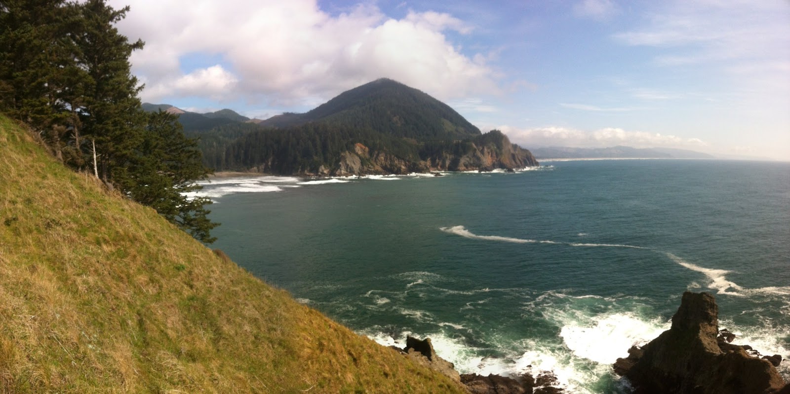
Eventually, I arrived back at the backpacker’s camp. I spent a few minutes taking pictures, checking out the old WWII bunkers and scoping out the views before heading back down to Indian Beach and eventually my car. In the end, it took me 2.5hrs of actual run time for the traverse. I did some quick stretching a fueling before jumping in the car and heading out to Oswald West State Park.
 |
| Weather getting better |
 |
| Looking back towards Cannon Beach |
 |
| Looking back at the Tillamook Head |
Leg 2: OAB to a little past Cape Falcon
I was able to refuel and rest a bit on the drive between trailheads. I parked at the large parking lot leading down to Short Sands Beach in Smuggler’s Cove. I loaded up my hydration pack with 50oz of nuun, grabbed a few more gels and made a 2.5hr bottle of Perpetuem. (My goal was to use Perpetuem as my primary fuel source for the day to see how my body would react/perform.) I wasn’t planning on coming back to the car between legs 2 and 3 so thats why I carried so much water and fuel. Also, by this time the weather was pretty great so the view would be awesome.
 |
| Small waterfall overlooking Short Sands |
 |
| Smuggler's Cove |
I had been too Short Sands Beach many times, but never hiked out to Cape Falcon. I was blown away with how beautiful it was and really enjoyed the non rooty parts of the trail. Salal Meadows was really amazing and climbing down to the view point was awesome. Definitely have to take some other people out there some time. I continued on another 1.5 or so to get some extra mileage before turning around and setting my sights on the summit of Neahkahnie Mountain.
Leg 3: Former Oswald West State CG to Summit of Neahkahnie OAB.
I started feeling pretty fatigued crossing the suspension bridge on the border of the CG. Next thing I knew I was starting up at a wall of trail. This section coming out of the campground is pretty steep so I jogwalked it to the top partly to save energy, partly because I was too tired to run. Coming into Elk Meadows, Neahkahnie loomed in front of me, daring me to attempt it. I strategically chose to attempt it at the end of run in order to see how my legs would react under fatigued conditions and to simulate a mental and physical challenge I knew I would face in the late stages of my races this summer. I’m sure Maiden Peak will make Neahkahnie look like an anthill when I crawl up it in the late stages of Waldo 100k.
 |
| Suspension Bridge towards 101 |
By the time I crossed 101 and headed up my last section of the OCT, I had lost my uphill gears. I power walked parts, hiked parts and jogged all the flatter parts (there weren’t many). Eventually, I made it to the rocky summit. Scrambled to the top and sat down. I soaked in the view for a bit. Then made a few calls to a few people to let them know that I was okay, but significantly behind schedule.
 |
| Looking back at Cape Falcon, about 1/3 of the way up |
 |
| Summit Photo. looking out towards Nehalem Bay |
I was worried that my quads would be shot and that the downhill might take longer than the uphill. Amazingly, my quads felt rock solid, and I was able to run down fairly easily and fairly quickly. I crossed 101 again and cruised back down to the CG and back up to my car. I sat down and drank some water for a bit then iced in the river before jumping into my car and heading to NB CG.
 |
| Tired Bryan |
In the end, the run took 5hrs and 21mins. Longer than each of the 50ks that I done… When I got back to Nehalem Bay Campground, I did the math. 29.1 miles with 5,800ft of elevation gain with rocky, rooty and muddy conditions…. Okay that makes me feel a little better.
In the end, I had a pretty bad bonk climbing up Neahkahnie. I also had a pretty bad bonk using Perpetuem when I did my WRT OAB a month or so good. The things is is that I feel pretty good then just hit a wall or bonk suddenly. I think if I stay on top of my fueling, slightly increase my Perpetuem intake and take the occasional gel, I should be okay. Other fueling notes, 50oz of water with 2.5 nuun tablets was a little too sweet/strong, doable but strong. Overall, I was happy with my body structurally, aka no feet pain, knee pain, hammy pain, calf tightness. The only thing that bothered me was my lower back and upper glutes/hips. They just felt sore and tired.
That night Andrew and I polished off a few growlers, feasted on foil bombs, swapped manly yarns and howled at the moon.
The next morning, we lounged around a bit, ate a beastly breakie, drank gallons of Starbucks Via, and broke camp. Before Andrew ventured out on this town Sunday epic, I took him to a super secret spot near Falcon Cove for a little adventuring. We hiked and climbed around a bit, explored rocky shores and looked for whales/seals/pirates and buried Spanish Treasure.
 |
| Falcon Cove |
 |
| Climbing down the cliff, not for the faint of hear. Yes you need the ropes |
 |
| Wuss |
All in all, Great fricken weekend.
UNT
Bryan